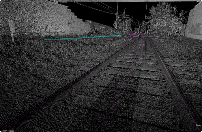
For four nights this summer, measurements were carried out between Ludvika and Ulvshyttan on track section 324 at Banorna in Bergslagen. A total of 31 km of tracks were measured. Carl Torstensson and Julius Jurisson from Strukton's measurement department were involved in this project.
The project was carried out on behalf of the Swedish Transport Administration ahead of an upcoming track and switch replacement.
No complete core network
A challenge on the route was the lack of a complete core network (geographically coordinated measuring points that are used as a starting point for measurements). A new core network would then have had to be established after the entire stretch before a measurement of tracks and objects could have been carried out. It had both taken a long time and cost a lot of money.
New measurement method with hand-pushed measuring trolley and laser scanner – Trimble GEDO IMS-Scan
Instead, they chose to test a new method that Strukton, supported by with the manufacturer Trimble and local dealer Trimtec, is evaluating. The method uses a hand-pushed measuring trolley to measure tracks and an attached laser scanner to laser scan the surroundings. Instead of positioning all measurements using a core network, a GNSS (GPS) unit is used in conjunction with an IMU (inertial navigation device). The absolute positioning is almost as good as when using the core network. Surveying, on the other hand, is much faster, and with the help of laser scanning, much more information about the surroundings is collected than with a traditional survey.
"It is estimated that with the traditional method and a measurement team, we would have managed to measure about 1 km of track per night (assuming that the core network exists). With the measuring trolley, we could instead measure 10 km of track," says Jacob Sandström, site manager at Strukton.
Could this method be interesting in more places?
"Yes, I think so. The method is very useful on line stretches where long, large stretches of track are to be measured. It also requires minimal preparatory work and could also be used together with track alignment to streamline track alignment during a track change."


Author: Strukton Rail

