Trimble GEDO Scan systems combine precise positioning with advanced laser scanning technology to provide high resolution data capture of the near-track environment.
Lengthy and personnel-intensive measurements are replaced by fast and automated data acquisition.
The obtained 3D point cloud data can be used to create accurate and detailed models of the existing infrastructure for the planning phase and construction management using the BIM method.
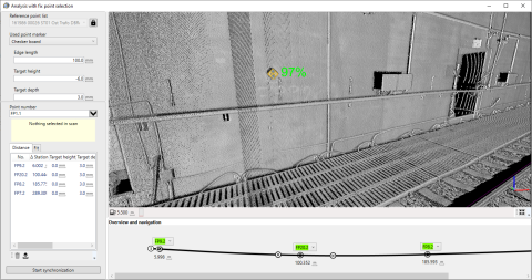
Clearance collisions in the area of tunnels, underpasses, platforms and other objects along the railway lines are detected and can be analyzed precisely.
The systems are used in the planning phase for data acquisition for modeling of the existing infrastructure, in the construction phase for acceptance tests, and in the operation phase for continuous clearance analysis.
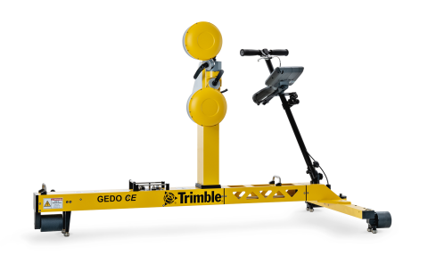
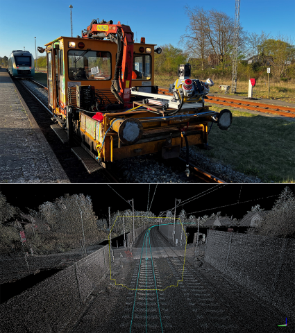
The Trimble GEDO Scan system consists of the Trimble GEDO CE 2.0 track measurement trolley with a Trimble control unit in combination with a laser scanner.
The purely relative kinematic scan system is suitable for all clearance analysis where only the relative perpendicular distance between objects and the current track position has to be determined.
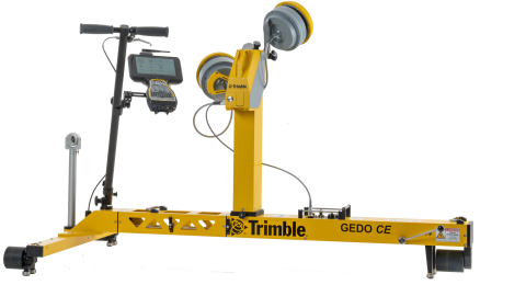
The Trimble GEDO Rec-Scan system consists of the Trimble GEDO CE 2.0 track measurement trolley with a Trimble control unit in combination with a laser scanner and a Trimble total station.
The system adds a laser scanner to a Trimble GEDO Rec geodetic system with a Trimble total station or Trimble GNSS receiver. An absolute referenced three-dimensional point cloud is generated, which can be used for as-built data collection for the design and construction phases, and for clearance analysis in tunnels or at any narrow points.
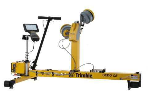
The Trimble GEDO IMS-Scan system consists of the Trimble GEDO CE 2.0 track measurement trolley with a Trimble GEDO IMU and a Trimble control unit in combination with a laser scanner.
The system adds a laser scanner to the highly productive Trimble GEDO IMS system. An absolute referenced three-dimensional point cloud is generated, which can be used for as-built data collection for the design and construction phases, and for clearance analysis in tunnels or at any narrow points.
The Trimble GEDO IMS-Scan system can also be used in conjunction with a Trimble GNSS receiver for absolute referencing.
Whether for planning, rail construction or asset management projects, the Trimble Mobile Mapping systems Trimble MX50 and MX9 provide a complete solution for a vehicle-based as-built survey that combines state-of-the-art hardware with intuitive field software and a reliable, efficient office software workflow.
The Trimble MX50 and MX9 systems efficiently capture high-precision survey data that facilitates the design of rail infrastructure and mapping of corridor features to build a comprehensive asset database. Expensive track closures can be avoided and the risk associated with pedestrian site access can be minimized.
The comprehensive data enables the delivery of a wide range of information. From track location to terrain models to the location of objects, information can be extracted and transferred to CAD and GIS systems.
Complete as-built documentation can be created after a construction project for the use in a BIM compliant project and throughout the lifecycle of the asset.
The Trimble MX9 system has been approved by Deutsche Bahn for track surveying and clearance testing according to Ril 883.