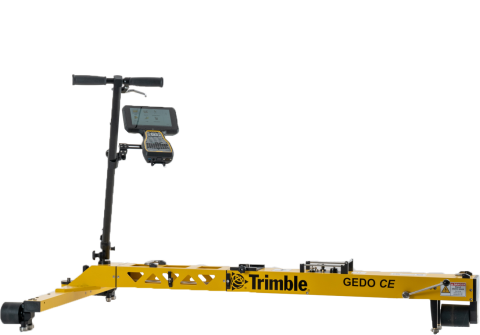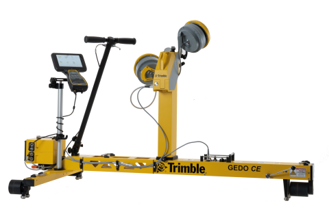
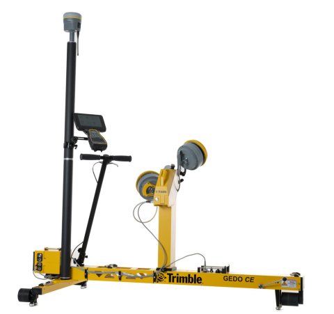
The Trimble GEDO IMS-Scan system consists of the Trimble GEDO CE 2.0 track measurement trolley with a Trimble GEDO IMU and a Trimble control unit in combination with a laser scanner.
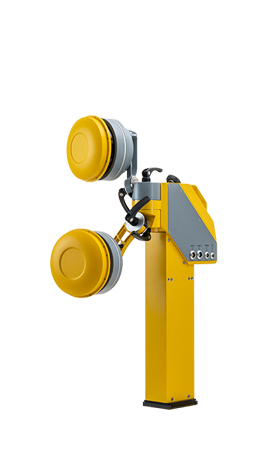
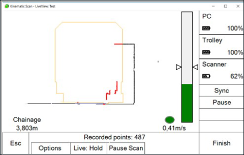
The system adds a laser scanner to the highly productive Trimble GEDO IMS system. An absolutely referenced three-dimensional point cloud is generated, which can be used for as-built data collection for the design and construction phases, and for clearance analysis in tunnels or at any narrow points.
The Trimble GEDO IMS-Scan system can also be used in conjunction with a Trimble GNSS receiver for absolute referencing.
GEDO IMS
- Control of the measurement with inertial measurement system and laser scanner
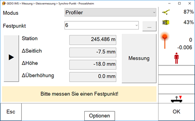
- Detection of the absolute track position together with track gauge, cant and twist
GEDO Scan Office
- Pre-processing and visualization of three-dimensional point cloud data captured in the field
- Generation of an absolute referenced three-dimensional point cloud
- Track specific analysis of point cloud data
- Measurement of object distances relative to the track centerline
- Clearance analysis with static or dynamic clearance profiles as well as wagon models
- Neighboring track detection for tracks visible in the scan
- Overhead line detection and distance measurement
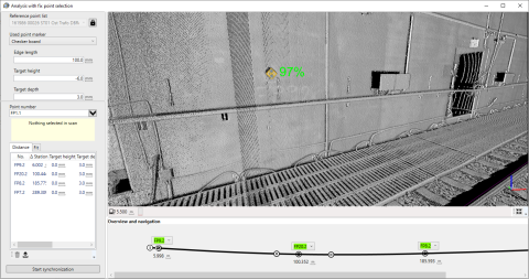
- Registration of points and lines directly from the point cloud
- Generation and vectorization of cross sections with DXF output
- Additional modules (i.e. WinLUE, Clearroute, Banedanmark) for clearance analysis according to track infrastructure operator requirements.
Trimble GNSS
The combination of the Trimble GEDO IMS system with Trimble GNSS technology enables as-built surveys without local control points in a given reference system.
- Highly productive measurement system for documenting the near-track environment through combination of inertial measurement technology and laser scanning
- Complex geodetic station setup procedures and associated restrictions are eliminated
- Short initialization time enables rapid deployment on site
- Use of a universal track measurement trolley with modular expansion options
- Modular design allows the use of a terrestrial laser scanner also for other surveying tasks
- Flexible alignment of the laser scanner for better object visibility
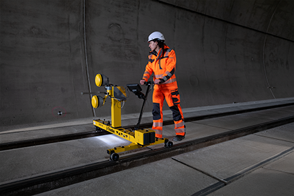
- Measurement of long sections of track and fast detection of bottlenecks without impact on train traffic
- High resolution and detailed capture of objects
- Specialized software for evaluation and documentation
- Navigation in the point cloud along the track axis
- Extensive clearance analysis functionality in three-dimensional point cloud based on actual and design track position
- Support of different calculation methods for clearance analysis with static or dynamic clearance profiles (wagon model, country-specific calculation methods, etc.)
- Neighboring track detection for tracks visible in the scan
- Overhead line detection and distance measurement
Planning, BIM and construction
- Documentation of the current state
- Basic data capture for planning and 3D modeling purposes
- Planning basis for the track alignment
- Clearance analysis with static or dynamic clearance profiles or wagon models for current or newly planned track alignments or for the use of new train sets
- Overhead line planning
- As-built documentation after completion for operation and maintenance phases
- Final inspection and variance comparison after completion of construction phase
Operation
- Clearance analysis for extra-wide transports and cross-border rail traffic
- Construction documentation for track infrastructure operators (i.e. WinLUE for LIRA, Clearroute)
Asset management
- Object registration