Field Software
GEDO IMS
Software for enhanced track geometry quality control utilizing the Trimble GEDO CE 2.0 track measurement trolley und Trimble GEDO IMU
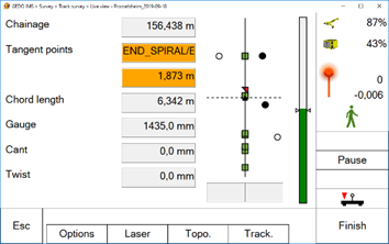
- Capturing of relative track geometry in combination with track gauge, cant (superelevation) and twist
- Control of track survey and capturing of absolute track position
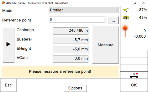
- Total station and GEDO Profiler support for control point measurement
- GNSS support via Trimble Access based GEDO GNSS application
- Special function for measuring topo points and platform edges
GEDO IMS module Alignment for working with alignment data
- Display of track main points and control points relative to track alignment
- Measurement to control points for variance comparison
- Display of the differences between actual and design according to track alignment after each section
- Fully automated geodetic resection after completion of first setup
- Optimized user guidance for track construction tasks
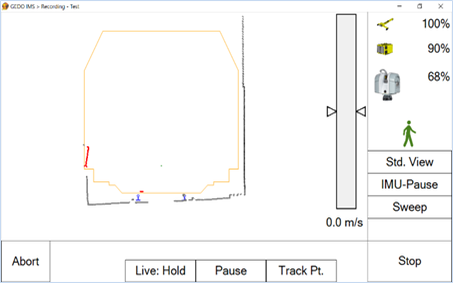
GEDO IMS module Scan for kinematic laser scanning
- Control of kinematic laser scanner during track measurement
- Clearance check in real-time
- Georeferencing via checkerboard marks or track reference points