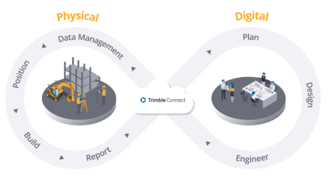
Trimble cloud solutions seamlessly connect field operations with office workflows to maximize the value of your railway infrastructure data.
Trimble Connect: A secure, cloud-based common data environment (CDE) and collaboration platform that optimizes data management by integrating field operations with office workflows. It serves as a secure, central hub and single source of truth for 3D design models and reality capture data, enabling seamless real-time collaboration across project teams and faster decision-making.
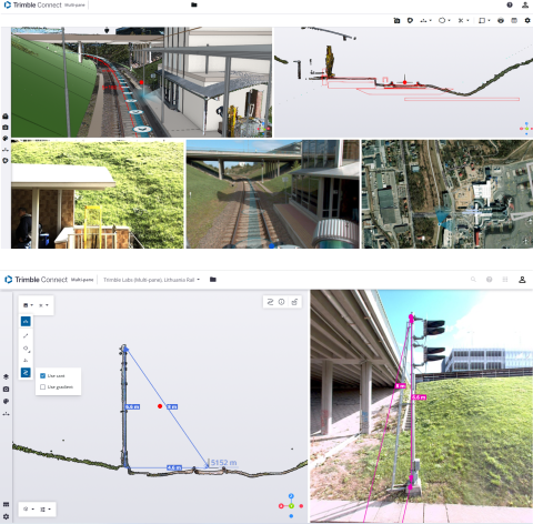
Trimble Reality Capture Platform Service (TRCPS) is an integrated cloud solution within Trimble Connect designed to centralize, manage, and share massive reality capture datasets, such as 3D point clouds and LiDAR scans. By removing hardware limitations and file transfer bottlenecks, TRCPS enables teams to visualize and overlay as-built field data directly onto BIM models in real time. This provides a single source of truth accessible to everyone—from the office to the jobsite—enhancing collaboration among stakeholders, accelerating quality control, and streamlining decision-making throughout the entire project lifecycle
Multi-Pane Viewer: A specialized cloud viewing environment within Trimble Connect designed to handle the unique scale and complexity of large infrastructure datasets. Accessible via the Trimble Reality Capture platform service, this capability allows users to view reality capture data and design models side-by-side in a single, high-performance analytical view. It transforms railway survey, scan and imagery capture data from GEDO trolley-based systems, Trimble MX vehicle-mounted mobile mapping systems and terrestrial scanners into accessible, actionable intelligence for railway professionals. Unlike traditional desktop software, Trimble Connect Multi-pane viewer runs entirely in a web browser - no installations, no high-end workstations required. Data streams from the cloud, making high-density point clouds, panoramic imagery (from MX systems), and precise track trajectories accessible to everyone on the project team, from track designers to construction supervisors to infrastructure owners.
More information