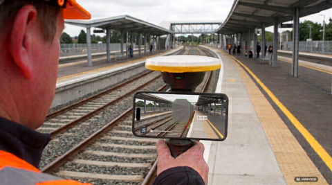
Transform railway infrastructure maintenance and inspection workflows.
Leveraging high-precision centimetric augmented reality (GNSS), field engineers can visualize BIM models, clearance envelopes, and BCF's streaming directly on-site. Without downloading heavy datasets onto mobile devices, operators compare as-built track conditions, catenary systems, and civil structures against digital designs in real time. This approach dramatically reduces time spent on the track, raises safety standards for field personnel, and enables early detection of clashes or structural deviations with unprecedented accuracy.
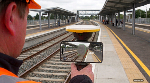
Integrating Trimble SiteVision with the Trimble Connect ecosystem and the TRCPS streaming service revolutionizes this workflow by delivering digital information models (BIM) and LiDAR survey data directly to the track. By pairing survey-grade GNSS positioning with Augmented Reality (AR), inspectors and maintenance teams can overlay digital models onto real-world conditions at a 1:1 scale with centimetric accuracy, turning complex data into instant, actionable decisions on-site.
Underground utility mapping: Gain "X-ray" visibility into buried signaling cables, conduits, and pipe networks beneath the ballast or along platforms prior to excavation or piling work, preventing accidental strikes and utility damage.
- Catenary and overhead line (OHL) Verification: Perform direct visual comparisons of contact wire height, stagger, cantilevers, and supports against design specifications—safely conducted from ground level without needing ladders or man-lifts for preliminary checks.
Clearance Envelope and Gauge Visualization: Project clearance limits and track gauge profiles in real time directly onto the track to immediately identify encroachment or clashes with vegetation, platforms, tunnels, or signals relative to rolling stock. - Track Alignment and Geometry Inspection: View alignment centerlines, tangency points and other specific elements via AR relative to actual rail positions, making it easy to spot structural deformations or ballast shifts quickly.
- Georeferenced Inspection Task Creation: Check office defined tasks and create new field tasks capturing photos of identified anomalies, attach notes and tags, and georeference them with centimetric precision. Reports sync instantly to Trimble Connect for engineering review.
- Direct AR Measurement & As-Built vs. As-Designed Comparison: Use built-in on-screen measurement tools to calculate distances, elevation differences, and offsets between physical assets and the digital model, minimizing manual measurement on active tracks.